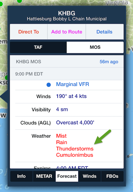
As icing AIRMETs begin to morph into convective SIGMETs, you’ll be happy to know that ForeFlight Mobile is ready for the upcoming convective season with some enhancements to its Model Output Statistics or MOS forecast. As was announced earlier, MOS provides a TAF-like forecast out to three days for over 2,000 airports in the U.S. and its territories. To help you anticipate convection during your preflight planning, MOS now includes a forecast for thunderstorms over the next three days as shown below.
April Showers
To celebrate the spring thaw, we are taking MOS a step further; in addition to thunderstorm forecasts, ForeFlight’s MOS product now forecasts showery precipitation at the airport as shown below. While rain showers may not seem like a threat to many pilots, it can be a precursor for deep, moist convection or thunderstorms, including embedded thunderstorms. So any forecast for rain or snow showers should get your attention since it means a convective process is anticipated even if natural lightning isn’t likely. Showery precipitation creates a hazardous environment capable of moderate or greater turbulence in those showery clouds. Additionally, a forecast for showers should raise a red flag that a serious threat of airframe ice may exist while flying in visible moisture at a temperature below freezing.
Finding MOS in ForeFlight
The MOS forecast is available to all subscribers with ForeFlight Mobile 6.6 or later. To find it in the app, simply select an airport or station from the Maps view. In the pop-over window, tap the Forecast tab at the bottom. Then tap the MOS button and scroll through the next three days to see if those springtime boomers may alter your plans.


