-
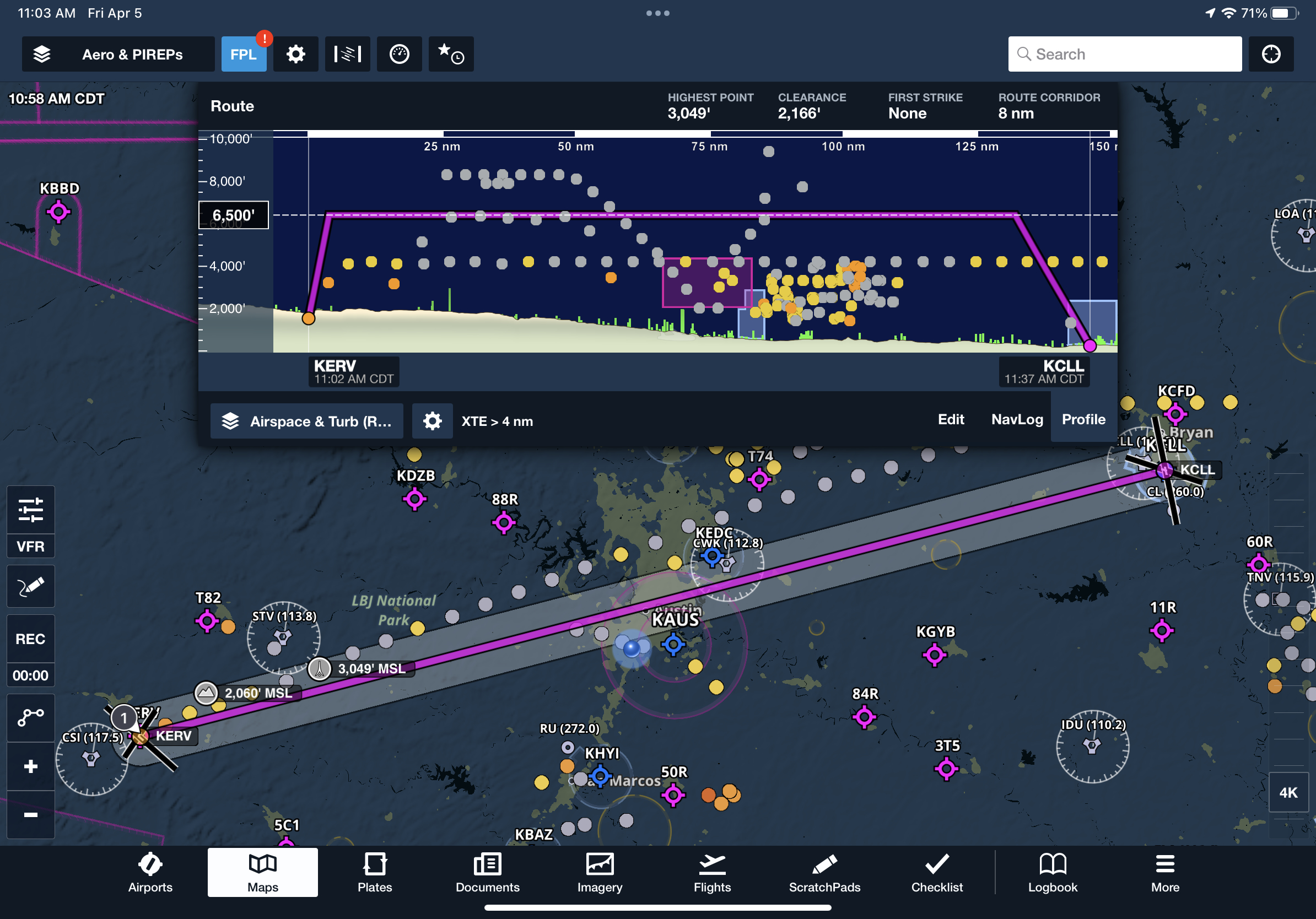
Smooth Skies: How ForeFlight’s Reported Turbulence Feature Helps You Plan Bump-Free Flights

When flying on a bumpy day, you’ll have heard other pilots checking in with ATC to ask for reports of smoother altitudes from others on frequency. Avoiding turbulence is not […]
-
Composite vs. Lowest Tilt Radar: What Pilots Need to Know
Lowest Tilt radar can be an important tool for pilots, providing a clearer picture of weather conditions at lower altitudes. We asked KOKI-TV Chief Meteorologist James Aydelott – a longtime ForeFlight […]
-
Dynamic Winds and Temperatures, Taxi Routing, Airport 3D Runway Lighting, and more in ForeFlight 13.3
One of our most feature-packed releases ever, ForeFlight 13.3 includes new Dynamic Winds and Temperatures map layers, the introduction of our ForeFlight Labs program for cutting edge features with Taxi […]
-
Daily/Hourly Forecasts, Parachute Jump Areas, and more in ForeFlight 12.11
ForeFlight 12.11 brings Daily/Hourly Forecasts for an all-purpose look at the weather, Parachute Jump Areas and Airport Hotspot details on the Aeronautical Map, and more. Daily/Hourly Forecasts Get a detailed […]
-
G-AIRMETs in ForeFlight
In 2008 the FAA’s Aviation Weather Center began phasing out AIRMETs (Airman’s Meteorological Information) in favor of G-AIRMETs (Graphical AIRMETs). In anticipation of the switch to exclusively using G-AIRMETs, ForeFlight […]
-
Weather in 3D Preview, Visual Approaches and Traffic Pattern Altitude, Internet Traffic Search, and more in ForeFlight 12.7
ForeFlight 12.7 includes Weather in 3D Preview, Visual Approaches and Traffic Pattern Altitude, Internet Traffic Search, and more. Weather in 3D Preview Enhance your preflight weather planning with interactive Icing […]
-
ForeFlight Adds New Forecast Graphics to Imagery View
We recently added two new collections of graphical forecasts to the Imagery view on mobile and web: Graphical Aviation Forecasts for cloud cover and surface conditions, and Ceiling and Visibility […]
-
A Closer Look at Global Icing, Turbulence, and Surface Analysis Map Layers
Available with ForeFlight Mobile 9.4, five new weather layers bring global Icing, Turbulence and surface pressure data to the map, with detailed Surface Analysis available to much of North America. […]
-
Surface Wind Analysis Now Available with SiriusXM
In ForeFlight Mobile 9.0 we’ve added a high resolution surface wind analysis to the list of map layers you can display through the SiriusXM satellite weather broadcast. This new product includes both windspeed and direction presented […]
-
Graphical Forecasts for Aviation (GFA) will become operational in April
Effective April 13, 2017, the experimental Graphical Forecasts for Aviation (GFA) produced by the NWS Aviation Weather Center (AWC) will transition to operational status. As you may have heard, the GFA was created in […]
Welcome to the
ForeFlight News Hub